We will be happy to help you choose the right route for you based on your preferences and experience.
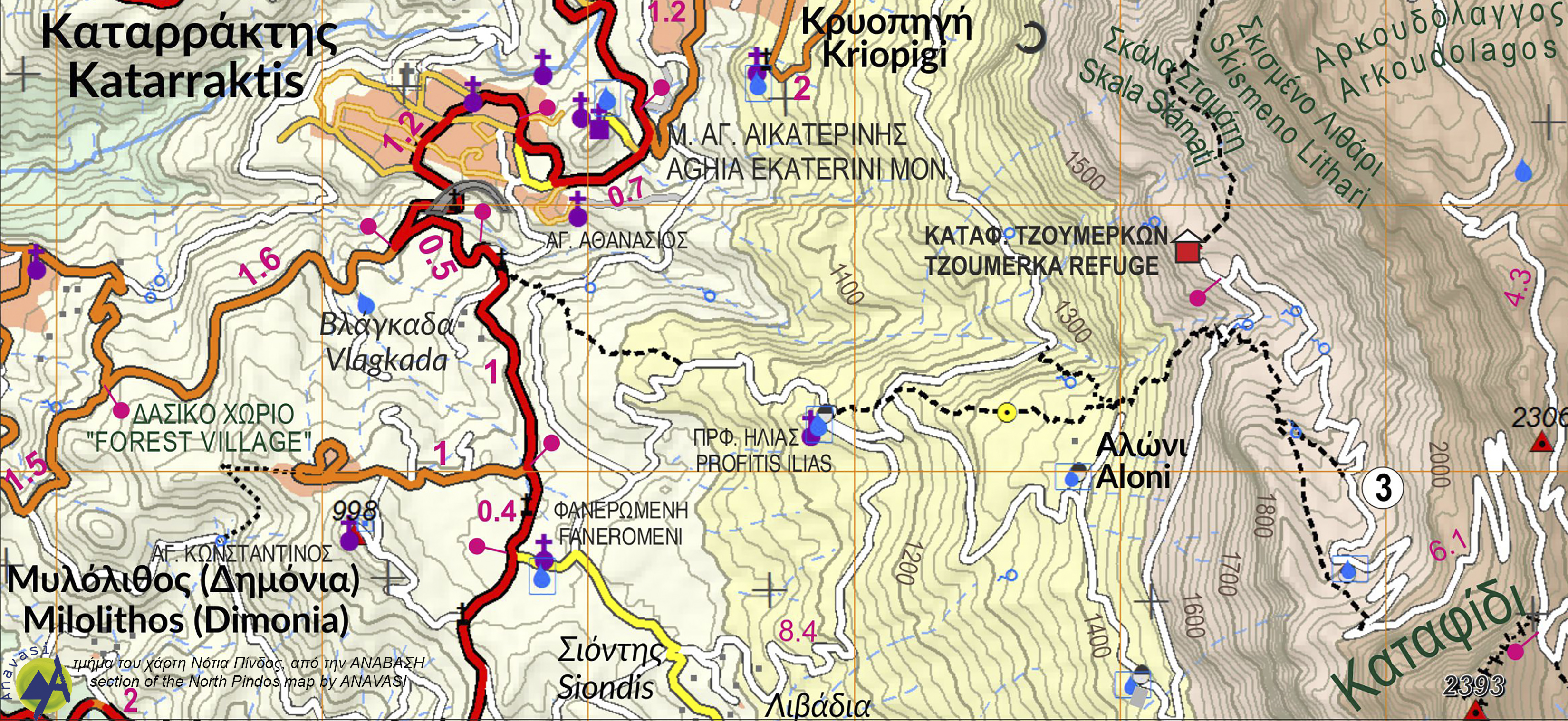
Section of the South Pindus map by ANAVAΣΗ
You can see various trails around the Refuge.
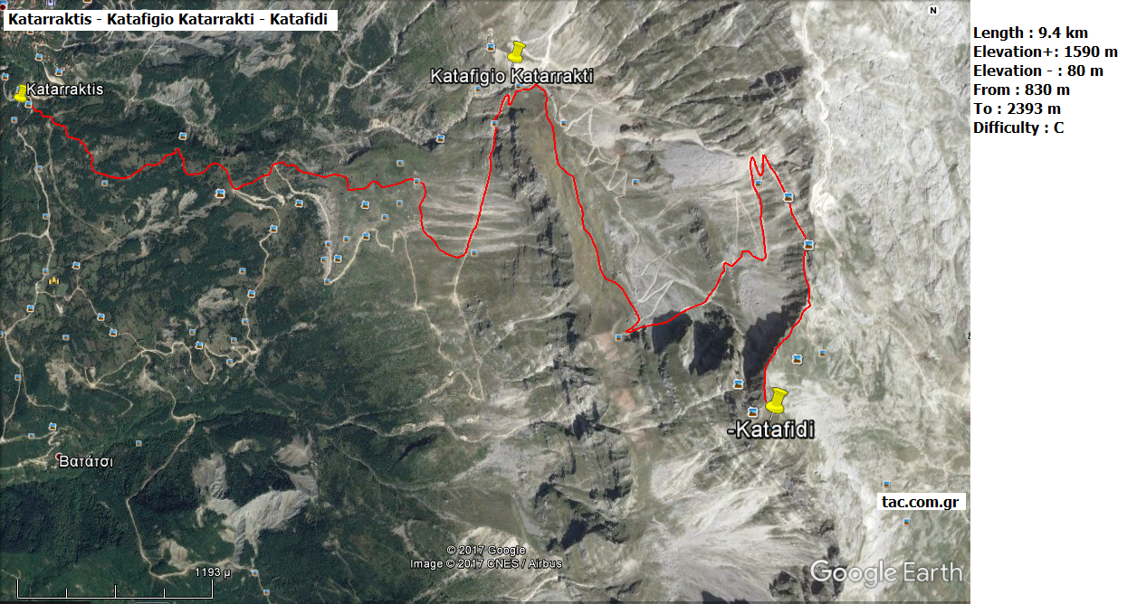
Trail from Katarraktis to Katafidi peak.
This trail starts from Katarraktis village and reaches Katafidi peak, passing through the Refuge.

Katarraktis Refuge - Bresena - Katafidi
This trail starts from the Refuge and heads towards Katafidi peak via Bresena.

Refuge - Agios Kosmas
This trail starts from the Refuge and heads towards Agios Kosmas.

Refuge - Waterfalls
This trail starts from the Refuge and heads towards the famous waterfalls of the namesake village of Katarraktis.
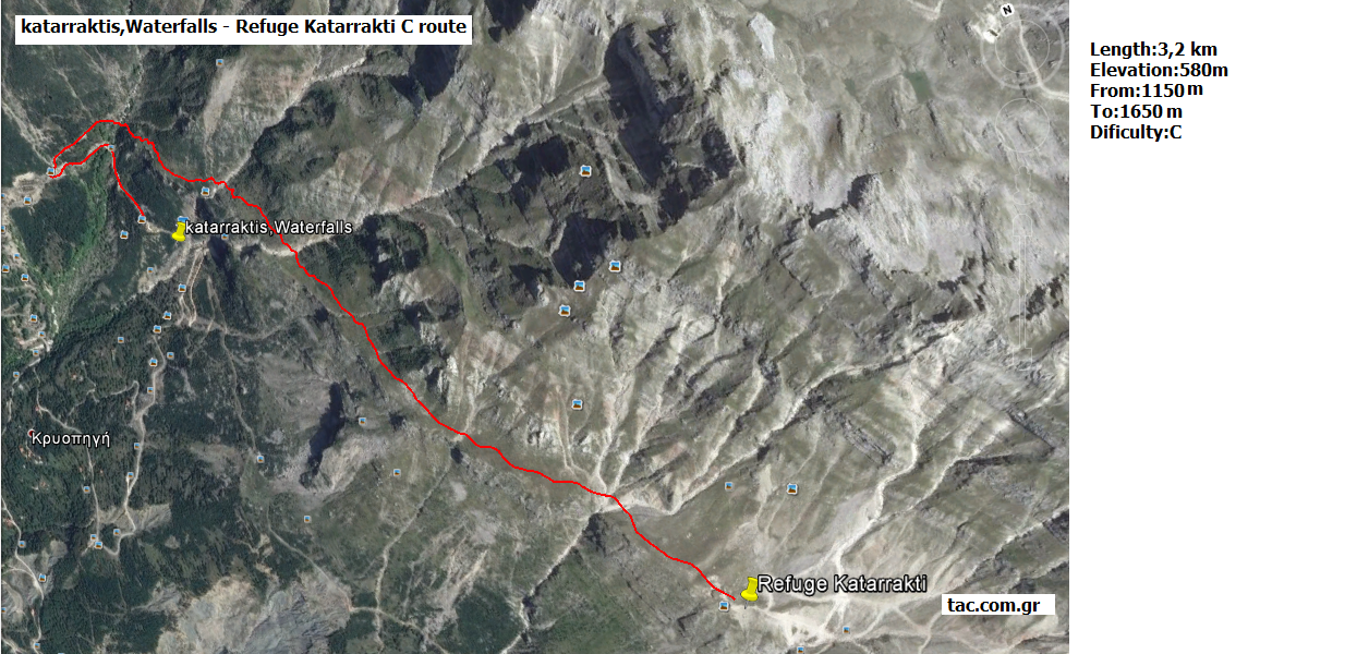
Waterfalls - Refuge
This trail starts from the waterfalls and heads towards the Refuge.